
Dalaroo Metals Ltd (ASX:DAL) has strengthened the scale potential of its 100%-owned Blue Lagoon Rare Earth Project in southern Greenland after geophysical surveys confirmed extensive sediment packages reaching interpreted depths of about 50 metres.
Independent ground penetrating radar (GPR) and single beam echo sounder surveys have provided the first detailed three-dimensional understanding of the sedimentary basin, while identifying multiple previously unrecognised sediment-filled valleys extending beyond the current exploration footprint.
The results support Dalaroo’s model that rare earth-bearing heavy minerals have been transported from surrounding alkaline granites and concentrated within shoreline sediments and adjoining depositional valleys.
Thick sediment packages confirmed
Dalaroo completed 21 GPR survey lines across five priority shoreline targets, where earlier surface sampling identified widespread rare earth element, zirconium and hafnium mineralisation.
The thickest sediment accumulations were recorded at Sites A, B and C, where interpreted depths commonly ranged between 30 and 50 metres.
Several areas reached the effective penetration limit of the GPR equipment, suggesting sediment thickness may locally exceed 50 metres.
Sites A and B contain extensive and continuous sediment packages that remain open at depth, while Site C showed increasing sediment thickness towards the shoreline and an adjoining peninsula.
The company said the size and continuity of the deposits demonstrated that Blue Lagoon contained large sedimentary traps capable of preserving heavy mineral-rich material.
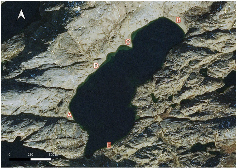
Location map of Blue Lagoon showing GPR survey areas.
Exploration footprint expands
A key outcome was the identification of numerous sediment-filled valleys extending from the surrounding alkaline granite terrain into the Blue Lagoon basin.
Dalaroo interprets these valleys as additional source-to-sink pathways that may have transported and concentrated rare earth-bearing minerals over geological time.
Their identification suggests the sedimentary system is considerably larger than previously recognised and creates several new priority targets outside the main lagoon area.
The company believes the valleys could host heavy mineral accumulations similar to those already identified along the Blue Lagoon shoreline, supporting the project’s broader district-scale potential.
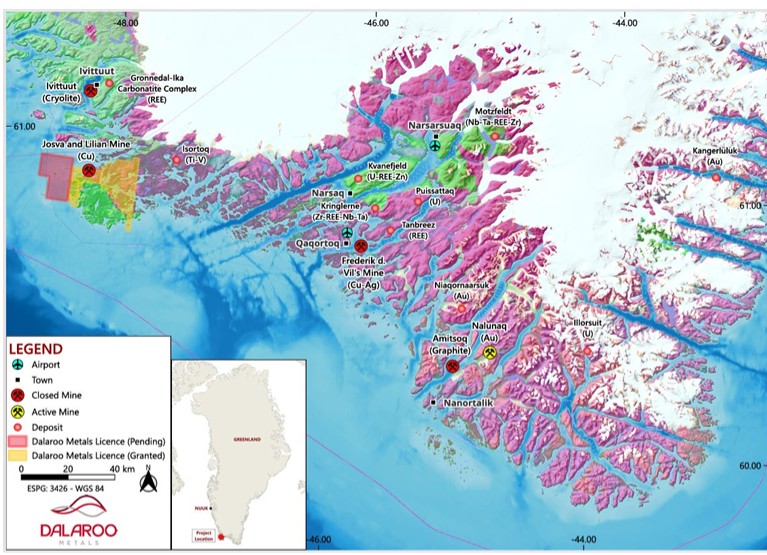
Location of the Blue Lagoon project in South-West Greenland.
Bathymetric survey completes basin model
Ten bathymetric survey lines were also completed across the lagoon, producing the first detailed model of its floor and basin morphology.
When combined with the GPR results, geological mapping, geochemistry and sediment sampling, the bathymetric data will help Dalaroo interpret sediment transport routes and the depositional environments responsible for concentrating heavy minerals.
Blue Lagoon is being explored as a sediment-hosted critical minerals system rather than a conventional hard-rock rare earth deposit. The thickness and continuity of the sediments are therefore considered important factors in determining its potential scale.
Next steps
Dalaroo will integrate the geophysical results with geological mapping and pending assay data to develop a three-dimensional geological model and refine targets for future auger drilling.
The company also plans to complete mineralogical and metallurgical studies, evaluate bulk sampling opportunities and assess the newly identified valleys during the 2027 exploration season.
Further exploration will continue across the broader Blue Lagoon district for additional sediment-hosted rare earth targets.