
Aurumin Ltd (ASX:AUN) will undertake exploration beyond the historical mining footprint with the aim of identifying repeats of Mt Palmer-style mineralisation at the 100%-owned Mt Palmer Project in the well-endowed Southern Cross Greenstone Belt in Western Australia.
Following drilling earlier in the year, the company’s exploration activities will progress to multiple potential targets as part of an expansion program.
Importantly, the targets identified are analogous to the historic Mt Palmer mine based on stratigraphic position and structural setting that require follow up.
Planned works include prospect-scale mapping and associated rock chip and soil sampling programs focusing on the identified targets scheduled to begin this quarter.
“High potential area”
Aurumin managing director Brad Valiukas said: “Our Mt Palmer Project remains an underexplored and high potential area.
“The project is positioned directly north of Yilgarn Star (>1 million ounces) and Nevoria (>400,000 ounces) and contains the historical high-grade Mt Palmer mine.
“We are continuing to improve our understanding of the project and have advanced our targeting of prospective areas.
“Field-based exploration including prospect mapping and soil sampling is planned to commence in November, inline with our strategy of working out from the historical mining footprint.
“Drilling at our Mt Dimer Project is expected to commence late next week, following a delay in drill rig mobilisation.”
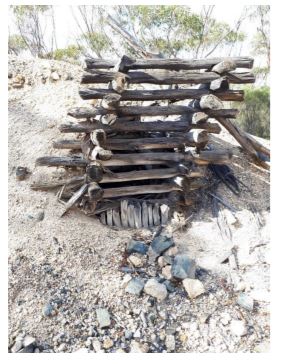
Historic shaft south of Mt Palmer mine.
Mt Palmer prospectivity
Aurumin’s recently completed mapping and litho-geochemical work confirmed the lower and upper mafic-ultramafic associations are within the Mt Palmer project while the sedimentary succession is interpreted to lie mostly under the lake sediment cover in the eastern part of the project.
Mineralisation at the historical high-grade Mt Palmer mine occurs within quartz veins that sometimes grade into associated pegmatite dykes.
The company’s recent fieldwork has led to the interpretation that the quartz vein arrays and pegmatites have occurred synchronously along with monzogranite sheets, before becoming mineralised during a later deformation event.
This observation indicates pegmatite dykes, along with quartz veins, are potential sites for gold mineralisation and the extent of both the pegmatite dykes and granite sheets may indicate the potential footprint of mineralisation.
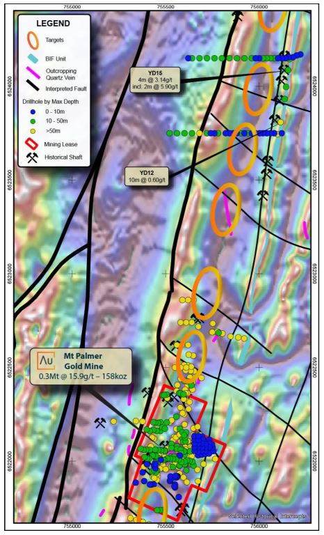
Identified targets north of the Mount Palmer mine showing historical drilling coloured by depth and interpreted structures underlaid by TMI derivative image.
Forward plan
In the near term, Aurumin will focus on strengthening the identified high-level targets, primarily based on structural and geological setting using geophysical data and project scale mapping.
This work will include prospect-scale mapping focusing on identifying and rock chip sampling outcropping quartz veins and pegmatite dykes, and interpretation of geophysical datasets across the broader project area incorporating insights gained through the mapping process; the identification of the oblique faults described above will be a priority.
Importantly, the work will be supported by soil sampling programs designed to refine and rank targets for drilling.
Based on the current data sets and Aurumin’s strategy of exploring outwards from existing deposits, exploration will focus on a 2-kilometre-long corridor extending, roughly 1 kilometre south and north of the historical Mt Palmer mine site.