
Critical Resources Ltd (ASX:CRR) has expanded its position around the Red Hat (NYSE:RHT) gold target within the 100%-owned Mavis Lake Project in Ontario, Canada, staking two additional mining claim cells covering about 40 hectares.
The new claims sit along strike from the Red Hat gold showing and are interpreted to contain historical drill hole RH11-03, which historical records report intersected 9.174 g/t gold over 1.2 metres from 133.8 metres.
The staking consolidates Critical Resources’ control of the Red Hat target area, allowing the company to assess the historical drill result and surrounding geology within a single exploration dataset. No purchase consideration or vendor royalty is payable beyond normal government staking and claim-maintenance costs.
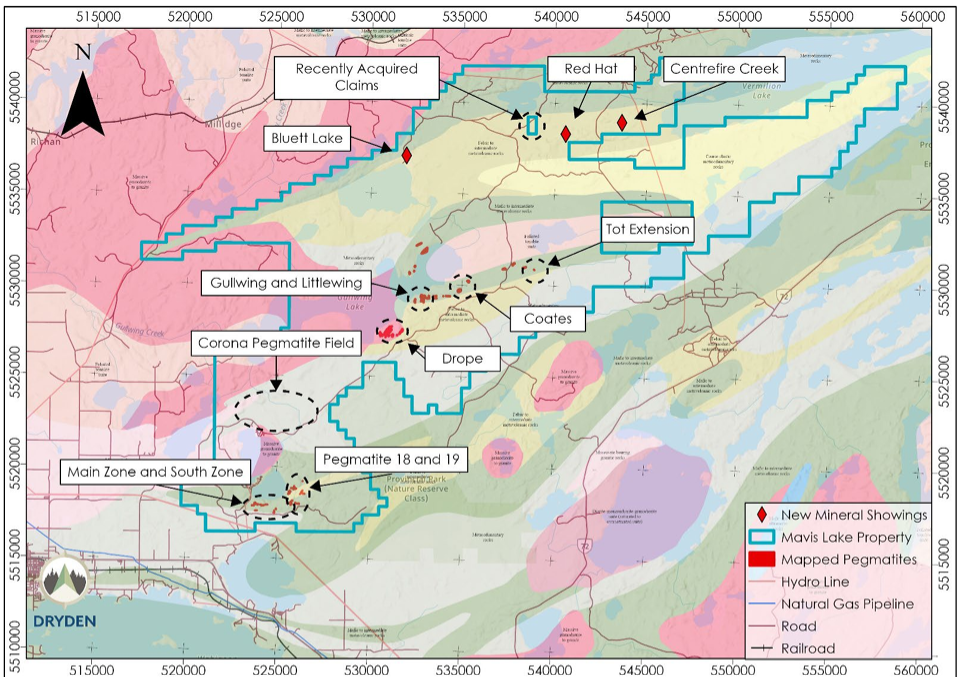
Mavis Lake Project map showing regional exploration targets, including the Red Hat area.
Historical gold result adds target
Red Hat forms part of an underexplored, approximately 14-kilometre east-west polymetallic trend hosted by felsic to intermediate volcanic rocks across the wider Mavis Lake tenure.
Historical exploration also includes a 2009 trenching program by Abitibi Mining Corp, which reportedly exposed an 18-metre interval averaging 1.1 g/t gold in weakly bedded and brecciated massive pyrite.
The RH11-03 hole was drilled to a final depth of 198.2 metres and returned the 1.2-metre gold interval as a downhole length, with true width unknown.
Critical Resources stressed that the historical result has not been independently verified and was not reported in accordance with the 2012 JORC Code. The company has not adopted or endorsed the result and said further evaluation could reduce confidence in the historical data. The company also noted that the high-grade interval represents a discrete sample within the 198.2-metre hole, while most other reported gold values from RH11-03 were low. The relationship between the drill intercept and the historical Red Hat trench result has yet to be established.
Verification work to guide next steps
Critical Resources plans to validate the underlying historical records and accurately locate RH11-03 before determining the next phase of exploration.
Subject to verification, permitting, seasonal access and exploration priorities, follow-up work could include geological mapping, prospecting, surface geochemistry, geophysics and confirmation drilling.
The company also intends to verify and digitise historical drill logs, assays, QA/QC and survey data, georeference historical plans and integrate the information into its Mavis Lake database and 3D geological model.
Mavis Lake resource base
The broader Mavis Lake Project covers more than 400 square kilometres and hosts an Inferred Mineral Resource of 8.0 million tonnes at 1.07% Li₂O.
Critical Resources has also defined a JORC-compliant Exploration Target of 18–29 million tonnes at 0.8–1.2% Li₂O, with additional lithium targets including Gullwing, Tot, Pegmatites 18 and 19, Little Wing, Coates, Drope and the Corona Field.
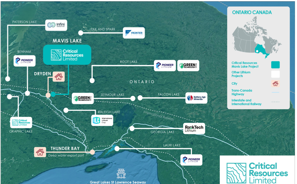
Location of Critical Resources Mavis Lake project with surrounding lithium prospects.