
Pinnacle Silver & Gold Corp (TSX-V:PINN, OTCQB:PSGCF) has revealed promising results from a recently completed airborne LiDAR survey over its high-grade El Potrero gold-silver project in Durango, Mexico, confirming known structures and uncovering new targets across the property.
The survey, which covered the entire 11-square-kilometre project, identified a total of 64 adits, six shafts, and 51 prospecting pits across Pinnacle’s two claim blocks.
On the northern El Potrero block, the survey confirmed the trace of the Dos de Mayo vein system, along with smaller exposures of the El Capulin and La Estrella veins. LiDAR data also suggests potential extensions to the southeast across the river valley, hosted in similar andesitic rocks, and a previously unidentified northeast-southwest structural trend that could host a different, intrusive-related style of mineralization.
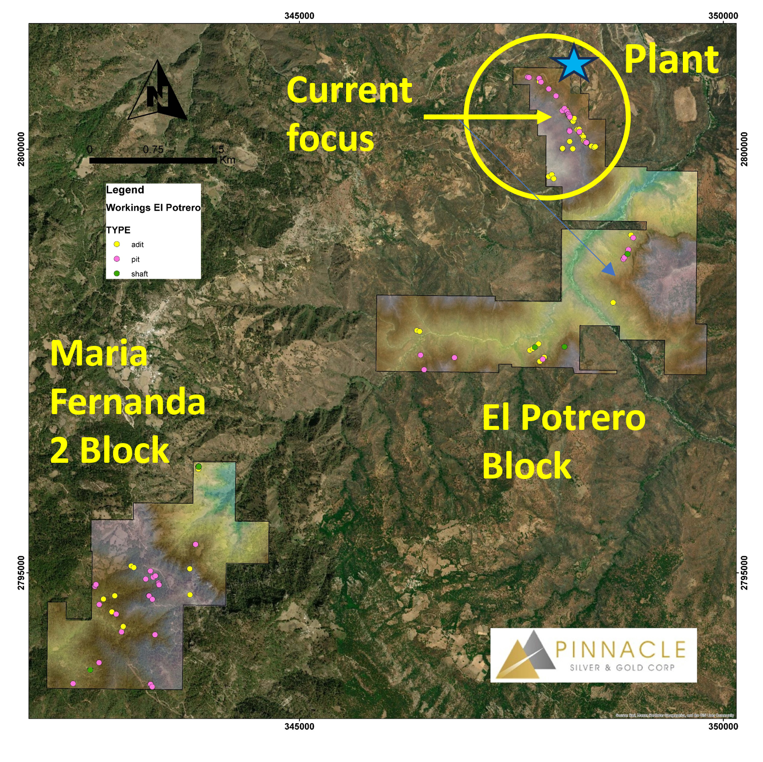
The southern Maria Fernanda 2 block showed scattered shafts, adits, and pits, and LiDAR identified smaller structures perpendicular to a northwest-southeast trend. Road cuts in the area display intense argillic alteration and pervasive chloritization with minor pyrite, which Pinnacle interprets as indicative of a possible buried hydrothermal system.
“The LiDAR survey was highly successful in confirming the 1,600-metre known strike length of the Dos de Mayo vein system and, perhaps more importantly, has identified new structures, often with artisanal workings that may indicate the presence of vein material,” said Robert Archer, Pinnacle’s CEO.
“The sheer number of historic shafts, adits and pits interpreted from the LiDAR survey underscores the prospectivity of the project and, to date, we have focused only on the northernmost 10% of the property. As such, we are adding to our geological team to follow up on these new targets.”
The company plans a systematic follow-up exploration program in early 2026 to evaluate these newly identified targets.