
Lithium Energy Ltd (ASX:LEL) has completed a passive seismic survey across its White Plains Lithium Brine Project in Utah, United States, identifying a half graben basin structure up to 600 metres deep. This geological formation is considered favourable for lithium brine accumulation, providing a compelling framework for continued exploration.
The company now plans to launch a magnetotelluric (MT) data survey across priority areas to refine drill targets. The MT survey will complement the passive seismic data, enhancing Lithium Energy’s ability to identify highly conductive lithium brine aquifers beneath the surface.
Executive chairman William Johnson said, “Lithium Energy is employing cutting-edge geophysical techniques to unlock the full potential of its exploration assets.” He added that combining seismic and MT data would offer a detailed picture of the subsurface basin, strengthening the company’s strategy to define a significant lithium brine resource at White Plains.
This integrated approach reflects Lithium Energy’s broader objective of delineating a maiden JORC (Joint Ore Reserves Committee) Mineral Resource at the project through successive geophysical and drilling phases.
Seismic survey outlines half graben basin
The program covered four East-West seismic lines totalling 38 kilometres, targeting the subsurface structure of the brine basin. Interpretation of the data revealed a half graben basin typical of the Basin and Range Province. Such formations commonly host aquifers adjacent to bounding faults within sandstone-dominated conglomerates.
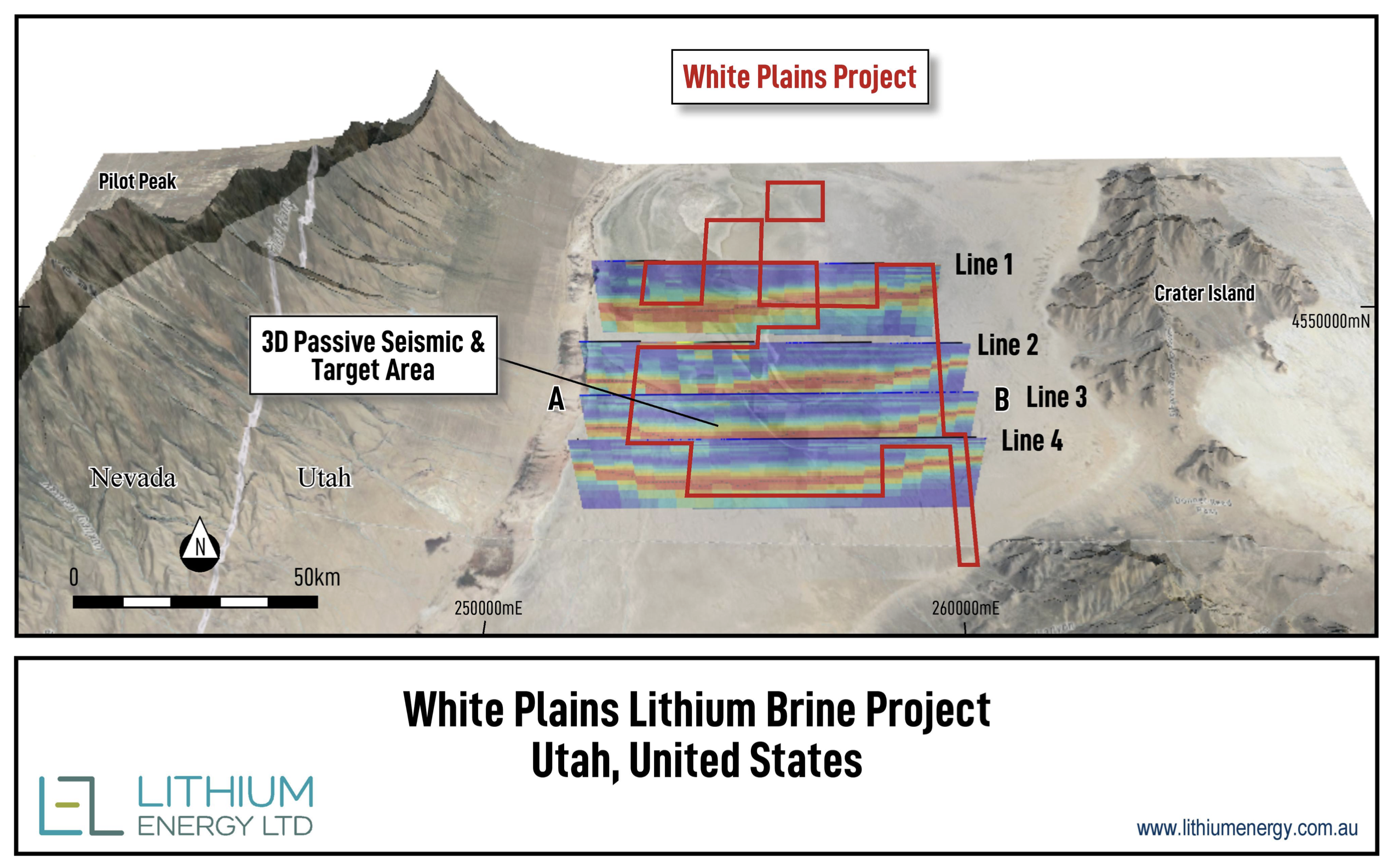
3D passive seismic survey results from 4 survey lines within the White Plains claims area (shown in red)
The depth to basement of up to 600 metres supports the project’s potential to host lithium-rich brine systems. The survey was conducted using TROMINO® passive seismic equipment, and results showed consistent geophysical patterns across the surveyed area.
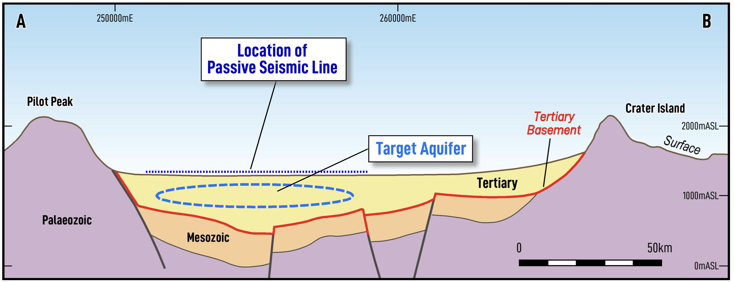
Interpreted A to B cross-section from passive seismic survey Line 3 (refer to pic 1).
Next phase: Magnetotelluric survey to define targets
Building on the seismic results, LEL will undertake a magnetotelluric (MT) survey. This method measures natural variations in the Earth’s magnetic and electric fields to detect highly conductive features such as hypersaline brines. MT surveys are particularly well suited to closed basin environments where lithium brines are often present.
By correlating the MT results with existing seismic data, LEL aims to pinpoint the most promising targets for its upcoming drilling campaign.