
Australian Gold and Copper Ltd (ASX:AGC) has uncovered a cluster of historic mines with rockchips grading up to 24.4 g/t gold.
The discovery comes after extensive historic gold mine workings were sampled just 35 kilometres north of Lake Cargelligo on one of three tenements in AGC's South Cobar Project.
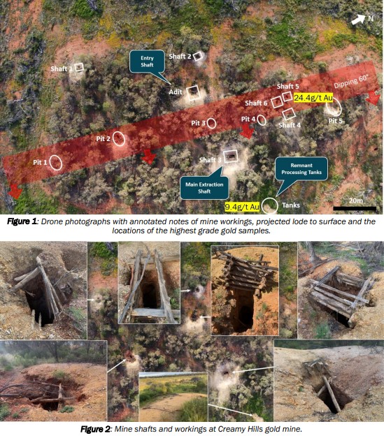
The mine workings were spread over 1.2 kilometres in length with a tight cluster of significant workings 250 metres in length and as deep as 80 metres.
First pass sampling, which was designed to determine the prospective rock types returned:
- rock chips to 24.4g/t gold within the shafts and dumps; and
- composite samples to 9.4g/t gold from mine tailings.
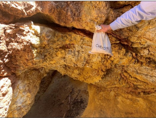
Photograph of Geo Glen holding the sample bag at its sample location that returned 24.4g/t gold within shaft 5 and looking into shaft 6.
The historical mines are known as Creamy Hills gold mines and are part of the South Cobar project, spanning 1.2 kilometres in length.
“We originally found these mine workings from satellite data and their proximity relative to the eastern Cobar Fault seemed incredibly important as many of the Cobar mines have similar positions,” AGC managing director Glen Diemar said.
“When we went there, we simply couldn’t believe the extent of the workings and the large amount of material excavated from these old mines. The extensive outcrop and lack of transported cover in this area enabled us to use soils sampling as an effective method of exploration. To our delight, elevated arsenic correlated with our mapping of the gold workings and rock chips. Extensive soil sampling program is planned to highlight high potential gold targets.
“Next week Fender Geophysics mobilises to South Cobar Project to complete three poledipole induced polarisation surveys which are used to discover zones of abundant sulphide minerals include copper sulphides. We are very excited about our future.”
Analogous to world class mines
The Creamy Hills gold mines are in a deformed wedge of folded rock within a back thrust of the major Woorara fault on the eastern edge of the Cobar Super Basin – a location considered an analogous position to the world class Cobar mines including the CSA Copper Mine north of Cobar which also sit within folds in the Rookery fault back thrust on the eastern edge of the Cobar Basin.
Without modern geochemistry, geophysics or drilling, there looks to be significant potential for expansion, with the targets open in every direction.
What’s next
So far, a limited soil sampling test line returned two zones of elevated arsenic anomalism suggesting multiple stacked mineralised faults.
The company will now complete a broader soil survey to map anomalism in the soils and expand the footprint.
Further to this, Fender Geophysics crews will mobilise next week at the South Cobar Project, to conduct three induced polarisation (IP) geophysics surveys, targeting gold and base metal deposits adjacent to major fault structures at the Achilles, Hilltop and Planet prospects.