
Alchemy Resources Ltd (ASX:ALY) has intersected fertile lithium-caesium-tantalum (LCT) pegmatites in reverse circulation (RC) drilling at the Hickory prospect within the Karonie Lithium-Gold Project in Western Australia.
Final assays from the RC program of 30 holes for 4,092 metres confirmed the presence of spodumene and lepidolite mineralisation in outcropping pegmatites identified from recent mapping as well as the northern extents over a strike length of about 1,000 metres.
Some of the best results include:
- HYRC006:
- 1 metre at 0.12% lithium dioxide (Li2O) from 67-68 metres;
- 2 metres at 0.11% Li2O from 72-74 metres;
- 3 metres at 0.27% Li2O from 161-164 metres, 53.2 parts per million (ppm) Ta2O5 including 1 metre at 0.47% Li2O, 70.3 ppm Ta2O5 from 162 metres;
- 1 metre at 0.12% Li2O, 23.7 ppm Ta2O5 from 174-175 metres; and
- 1 metre at 0.18% Li2O, 23.1 ppm Ta2O5 from 178-179 metres;
- HYRC001: 1 metre at 0.17% Li2O, 37.1 ppm Ta2O5 from 39-40 metres;
- HYRC016: 1 metre at 0.12% Li2O, 34.7 ppm Ta2O5 from 63-64 metres;
- HYRC034: 1 metre at 0.1% Li2O, 33.0 ppm Ta2O5 from 111-112 metres; and
- HYRC037: 1metre at 0.1% Li2O, 37.1 ppm Ta2O5 from 70-71 metres.
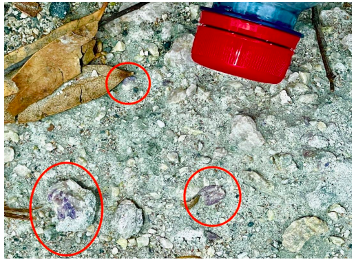
Lepidolite (circled red) in HYRC006.
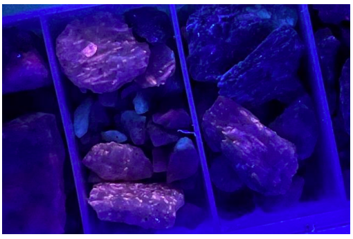
Spodumene crystals under 365nm ultraviolet light from HYRC006.
“Fantastic start”
“The discovery of extensive stacked pegmatites with the confirmation of spodumene mineralogy is a fantastic start to exploration of this new lithium province,” Alchemy’s chief executive officer James Wilson said.
“The assays confirm we are dealing with an LCT pegmatite system which is open at depth and continues for roughly 3 kilometres to the north and west under shallow alluvial cover, masking any surface geochemical expression.
“Gravity surveys have recently been completed with data processing and interpretation underway which we believe will help map the pegmatites under cover and guide the next steps.”

Forward plan
- Continue detailed mapping in the areas north of Hickory to further enhance the geological model.
- Finalise processing of the high-resolution gravity survey to assess the potential to map the pegmatites under cover to the north.
- Planning for follow-up programs once all results have been received and interpreted.
- Further assess the application of other geophysics methods, including detailed radiometric surveys or deep ground penetrating radar, to map out potential extensions of the pegmatites under cover to the north.
- Planning underway for follow-up reconnaissance mapping and sampling of Lake Rebecca tenure.
- XRD analysis of drill samples to enhance understanding of the pegmatite mineralogy at Hickory.